How To Learn Marine Navigation (Easy In-Depth Guide)
Learning marine navigation can seem difficult, but when you break it up, it's actually pretty simple. Below, I'll go over the exact steps of learning marine navigation quickly.
How to learn marine navigation? In order to learn marine navigation, you need to understand how to locate your position (using bearings, GPS, stars, etc.), how to read nautical charts to determine a course, how to plot a course on a nautical chart or chartplotter, and how to use a compass (in order to monitor the course).
This still might seem like a lot. Don't worry. I have written detailed articles on all of these different steps. Below, I'll summarize the main takeaways for each step, and link to other articles so you can explore in more detail on your own. Ultimately, marine navigation all boils down to the way you get your lines. Let me explain.

On this page:
Fundamentals: How Marine Navigation Works
You first have to understand the fundamentals of marine navigation. Marine navigation consists of three very simple steps:
- Locate your position
- Determine a course
- Monitor the course
If you say it like that, it doesn't seem so difficult after all, right? There are all kinds of ways to locate your position, to determine your course, and to monitor the course. That's what makes it seem difficult. But in the end, it's always these three steps. For example:
- You locate your position by using GPS
- You determine a course based on a nautical depth chart and the wind direction
- You monitor the course using a compass or your GPS
Locating your position can be done with any kind of directional line, for example using landmarks, buoys, stars, or satellites (which is GPS).
Your navigation technique is simply the way you choose to get your lines. It is always recommended to have multiple ways of determining your location, just to be safe in case you have some sort of system failure.
Find all types of marine navigation in my in-depth guide here
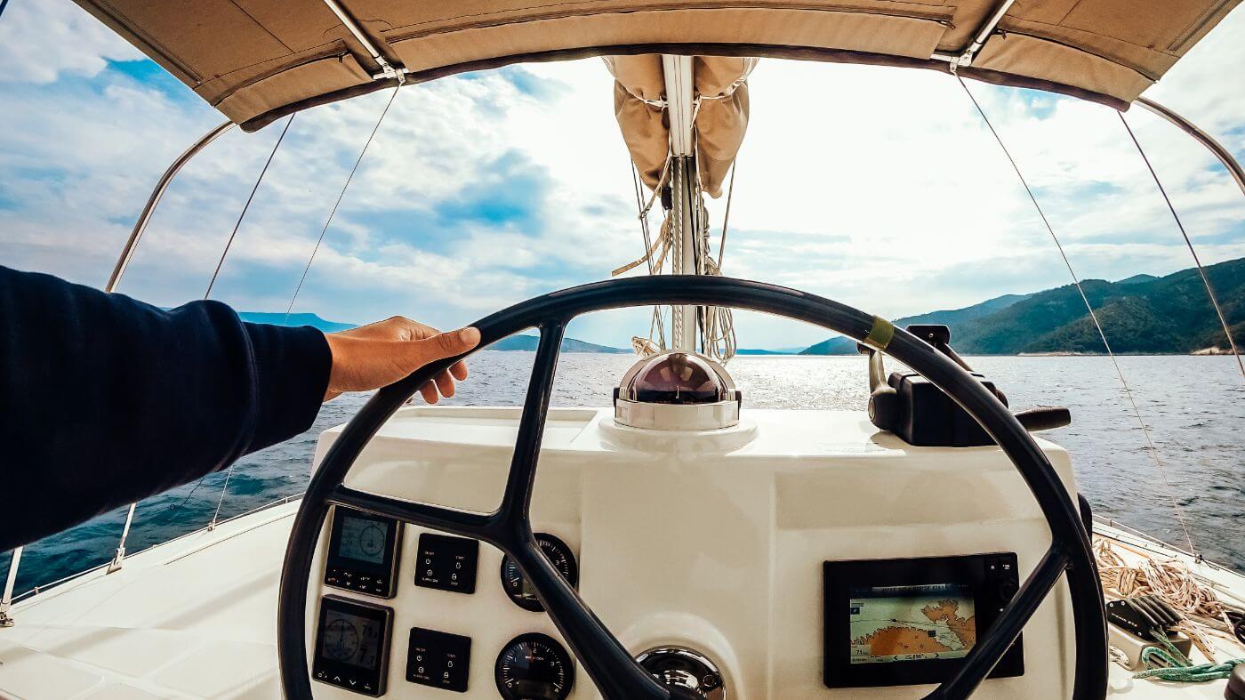
How To Use a Boat Compass
Using a boat compass may seem straightforward, but many people make mistakes that are easily avoided. Especially if you're just starting out, it's easy to make mistakes that may have large consequences.
The most common compass is the magnetic compass, which will work 99% of the time. There are situations in which a GPS compass may malfunction. Same goes for the magnetic compass. Having at least one extra back up compass is therefore recommended. Most sailors agree that a solid magnetic compass is the default choice for reliable navigation.

So how do you actually use a boat compass?
- The lubber line (a small line on the compass) marks your direction on the compass card.
- The direction is given in degrees.
- You pick a course on a nautical chart.
- Then, you steer the boat so that the lubber line points to the correct degree on the compass card.
- You keep course by making sure the lubber line stays put.
Most important compass lessons:
- Before leaving the marina, always check your compass' alignment
- Remember or record your reciprocal course - the opposite direction of your course current course. The reciprocal course will always get you home.
- A compass is still an important tool, even with GPS, since a compass tells you direction, not just track.
- You should mount your compass away from metals and electronics, otherwise it will deviate
- You should calibrate (swing) your compass after mounting
The compass will always point to magnetic north. However, the position of magnetic north changes all the time (less than 6 meters per year on the surface). The closer you get to the poles, the larger the navigational error margin becomes.
It's important to understand your compass well
If you're new to sailing, I highly recommend reading up on the compass and learn how to use it the right way in this article.
How To Read and Use Nautical Charts
We understand our compass and have a sense of the fundamental concepts of marine navigation. Now it's time to take a close look at nautical charts. William has written a very good series of articles on using nautical charts.
Here's the entire series in the recommended reading order:
- Nautical Chart Types Explained
- Ultimate Guide to Nautical Chart Navigation
- How To Plot a Course on a Chart
William is an experienced sailor (he has sailed the world for eight years) so he really knows what he's talking about. After reading this series you will be up to speed on chart navigation. If you're currently just orienting, I will summarize each article and talk about the takeaways below.
Different types of nautical charts
The most common type of nautical charts are navigation charts, which is what most people refer to when they talk about nautical charts. You'll be using navigation charts most of the time, although there are some other types like pilot charts.
A navigation chart is like a road map, with one important distinction: road maps contain roads, nautical charts don't. Nautical charts are more like geographic maps, showing depths, ridges, islands, shallows and similar features. They also contain important landmarks you can use to determine your position.
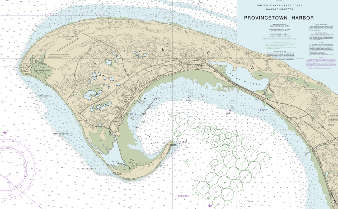
When using a chart, you want to pay attention to the scale. Typically, you want to use the largest scale charts possible, since those contain the most details. These are called large scale charts, coastal charts, general approach charts, or harbor charts. Smaller-scale charts are only useful for planning long voyages. You have to be careful with those since they won't contain every shallow or reef.
For an illustrated overview of the different nautical chart types, I recommend reading this article on chart types.
How to use nautical charts
Using nautical charts is as easy as pie - if you know what each symbol means and how to interpret the excess of information on there. In William's Ultimate Guide to Nautical Chart Navigation, he walks you through each and every item on there, with examples so it's easy to understand.
What you'll need to know in order to navigate safely:
- Navigation basics - what basic tools we have to navigate
- How to read a chart - interpreting all the information on the chart
- How to use a chart - plotting a course
How to read nautical charts
Generally, you'll find the following information on a good chart:
- Latitude and Longitude Lines
- Scales, Depths, and Notes - tides and currents, navigational marks
- Compass Rose - indicates the orientation of the map
- Depths and Contours - small numbers that state the depth of the bottom
- Symbols, Marks and Lights - things like hazards, landmarks, lighthouses
For a detailed explanation of each of these, go read the full guide on nautical chart navigation.

Coordinates
When navigating using nautical charts, we use coordinates to indicate positions. Coordinates consist of a latitude and longitude line. Charts have a geographic coordination scale which you can use to find these lines. Top and bottom of the map show longitude. The sides of the map show lattitude.
Symbols, Marks and Lights
You can find an overview of all the symbols and marks on the U.S. master list, which you can download here:
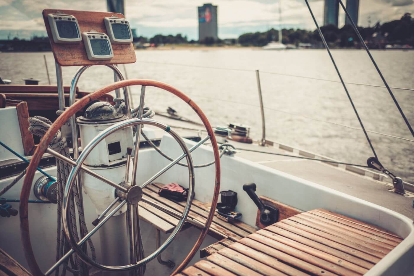
Plotting a course on a nautical chart
Now you have the right chart, next up is plotting a course on it. You can use a chartplotter, which is essentially a GPS with a map underneath which does the plotting for you. However, it's still important to learn how to plot yourself, since electronics can (and will) fail at one point or another.
Getting good at plotting takes a bit of practice and an ordered routine. Once you get it down, however, it becomes a piece of cake.
You need three basic navigation tools: a parallel ruler, dividers, and the chart itself.
How to plot a course on a chart:
- Draw a line from point A to B - using parallel rules, from starting mark to next mark
- Check the line for safety - if not, move end mark until you get a safe leg
- Measure and mark the heading - transfer the leg to compass
- Measure and mark the distance - measure the legs
- Repeat until you get there
For more explanation on these steps, please read our article How To Plot a Course on a Chart (Illustrated Guide).
My Recommendation for a Chart Navigation Course
When you're ready to master chart navigation, I recommend you check out the Coastal Navigation course at our partner NauticEd. It is quite excellent. They cover chart navigation in-depth and will guide you through multiple quality exercises to make sure you really practice your new skills. It is really affordable as well.
You'll leave Coastal Navigation Clinic with an understanding of:
- The Charts and how to use navigation tools
- True north and magnetic north - and variation and deviation
- Determining your position using various techniques such as dead reckoning, running fixes and triangulation
- What to do with your GPS position to get you to your destination
- Set and drift from wind, tides and current
- How to simply determine your heading based on Set and Drift
Check out NauticEd's Navigation Clinic now.
My Recommendations for Navigation Gear
If you're ready to start navigating but are unsure what kind of equipment you should get, you should check out my recommendations. I have previously recommended a good beginner chartplotter, handheld GPS, and boat compass.
My recommendation for a boat compass
I recommend the Ritchie Navigation Explorer (click to check current price on Amazon) - This compass is competitively priced, good looking, simple, reliable and rugged. Bracket mount (which I like). Also called the B51, it's the all-round best compass for most people. Best bang for the buck.
If you want to read the whole review, you can read my recommendation for a boat compass here.
My recommendation for a chartplotter
I recommend the Garmin echoMAP CHIRP 54cv (check current price at Amazon) - This chartplotter is good for both inland and bluewater sailing, and made by the best-known brand for marine navigation in the world.
If you're looking for a budget handheld alternative, I'd consider the Garmin Striker 4 (check current price at Amazon) - This simple handheld chartplotter offers mostly the same functionalities as the more expensive echoMAP, at a really competitive price. Incredibly, it also comes with a transducer, allowing you to use echo.
If you want to read the whole review, you can read my recommendation here.
Did you find the answer to your specific question?
👍 11 👎 2
Comments
bill
Thank You Sir
how does it feel when a huge wave is about to unravel you in sea when sailing
Bobbi Bex
What fabulous ideas you have concerning this subject! By the way, check out my website at <a href=”https://wwwbitcongressorg2105f.zapwp.com/minify:false/asset:http://71n.de/rueckenmassage-zur-entspannung">71N</a> for content about Thai-Massage.
Leave a comment