The Different Types of Marine Navigation
There are a lot of different marine navigation methods, instruments, and systems to navigate the seas. In this article, I'll explain most of them, including the navigational instruments that are most used by sailors today.
What types of marine navigation are there? Celestial navigation, dead reckoning, inertial navigation, and electronic navigation. One can either determine location based on a previous location (dead reckoning), or based on some sort of object (star, landmark, or buoy). Some commonly-used tools are the compass, GPS, radar, and sextant.
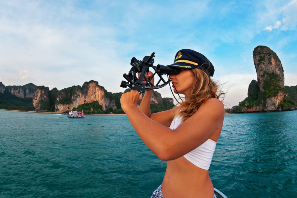
That last one is a bit of a cliché, but my guess is that every sailor secretly wants to use a sextant (at least I do). Well, here's the good news: you should. Celestial navigation is old, but not outdated. And that goes for most methods. GPS is definitely better in many ways, like most modern solutions - like pizza delivery. But you still want to know how to make your own.
On this page:
What is Marine Navigation?
Marine navigation is the use of navigation techniques to guide a (sail)boat from one point to the next.
All forms of navigation have four steps:
- you locate your position
- you determining a course
- you monitor the course
- and repeat
What is a navigation technique? A navigation technique is a way to determine the navigator's position and to set the desired course. There are different methods of locating your position, different plotting methods, and also different ways to determine your course. The system of locating, plotting, and setting a course is called a navigation method.
The most common navigation methods are satnav, dead reckoning, and radar navigation.
- Dead reckoning
- Pilotage
- Celestial navigation
- Inertial navigation
- Radio navigation
- Radar navigation
- Satellite navigation
Every method has advantages and disadvantages. For example, dead reckoning and radar can be used to determine your location based on just one point or object. But you need a lot of equipment. Celestial navigation is very reliable, but you need clear skies. Satellite navigation is very accurate, but you need a power source.
Celestial navigation is one of the oldest navigation methods. The navigator uses the celestial bodies to determine his location.
With Coastal navigation, the navigator uses the shape of landmarks along the coast, and the direction of the coastline.
With Inertial navigation, you use motion sensors to calculate your new position relative to the starting position. (This is a form of dead reckoning.)
Pilotage simply means fixing your position with a very high frequency and is used in harbors and restricted waters.
Radio navigation uses radio waves to measure the direction to a radio source. For this to work, you need radio towers all over the place. GPS is winning the battle for sure.
Radar navigation is mostly used to avoid collisions when you're close to land or other ships.
Satellite navigation is the most used form of navigation nowadays. This uses multiple satellites to pinpoint your location.
Experienced skippers always have multiple navigation methods at hand: and so should you.
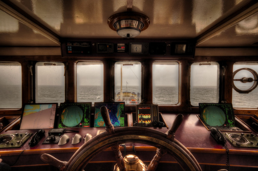
You can use analog or electronic equipment to get your position and plot it. A lot of the electronic instruments are actually just modern replacements for the old tools: they pretty much do the same job (but faster and better). A chartplotter is just a GPS version of a compass, a chart and a ruler (okay, I agree, it's a bit more complicated).
Old methods are less accurate than GPS - but they are pretty darn close enough! Celestial navigation can be very accurate if you do it right. Old skool methods are a great backup (and also cool to learn). They're always available: during solar flares, outages - some even without equipment.
You can use all kinds of navigation systems. The most used on modern-day boats are:
- GPS receiver
- Chartplotter
- Compass
- Radar and echo sounder
- Inertial navigator
Locating your Position
You can determine your position based on your previous position, or you can look out and use pretty much any kind of landmark, celestial body, and so on, to pinpoint where you're at.
If you use objects, you can do two things with them: you can measure your distance from them. And you can measure the direction to an object. The direction to an object is called a bearing.
If you don't have a compass, you can still get a directional line. Find two charted objects that align (like some rock formations or two buoys). This is called a transit.
By plotting the bearing or transit on a chart, you know along which line you're moving.
Then, if you measure the distance from you to an object, you get a line of position (LOP). If you plot this on a chart, you get a circle or arc.
If you draw two LOPs, they will intersect. This point is called the fix. That's your position. If you plot two or more bearings, you also get a position fix. Want to be very accurate? Use a bearing and a transit.
It's as simple as that. All navigation equipment essentially do one of these two things. Find some lines, make them intersect.
Different Techniques to Get Some Lines
So you need lines to know where you are. A navigation technique is simply the way you chose to get your lines.
Wikipedia here says that using lines of position is just one of the techniques, but I disagree. Satellite, radio, radar - all these methods use some sort of distance or directional lines to tell you where you are.
To get yourself some lines, there are plenty of old skool methods and modern ones as well.
- Compass bearings - you can use a compass to get a bearing, which is the most used way for many centuries now
- Terrestrial range - if you find that two charted points align, this gives you a directional line
- Radar range - measuring the distance and direction to an object, you only need one object to get your position accurately
- Observing celestial bodies - using a sextant you can get LOP from celestial bodies
- GPS uses 24 satellites (that's 24 LOPs) to pinpoint your exact location
- Echo sounder - not as accurate; can only confirm the boats known position
- Parallel indexing - uses echo to keep a safe distance from the shoreline, rocks, and so on
- Dead reckoning - using your previous location and speed and course to fix a new position
- Light dipping - using the height of a lighthouse to measure the distance from it.
Compass bearings
Getting a compass bearing is easy. You find a point on a chart you can see on the horizon, and you point your compass at it. Read the angle on the compass, and simply draw a line in that angle across the point of reference. The classic way is three compass bearing on three widespread objects.
For this method, you need a compass and a marine chart.
You don't have to go overboard when buying a good, reliable compass. It's pretty affordable. If you want to know what I use, read my article here. It's so good, I even have one in my car.
Not sure how to use a compass? Read the complete beginner's guide here.
Terrestrial range
If you don't have a compass, you can still find your direction by using two landmarks or objects. When two charted points align with your bowsprit, for example, two buoys, you can draw a line through them. Voila, you know your direction. This line is called a transit.
For this method, you need a marine chart.
Radar
Radar is different and pretty neat because it only needs one object to get a pretty accurate position. It can get the range and bearing from one object and plot it directly on the chart. So it's extremely useful if you navigate let's say a massive container ship in a crowded, tight port.
Celestial navigation
For celestial navigation, you need a couple of tools: a nautical almanac, a marine chronometer, and a sextant.
You first use the almanac and chronometer to pick a subpoint. That's the point where the planet or star is currently located above Earth. Then, you take the sextant to measure the angle between the celestial body and the horizon. This gives you the distance between you and the subpoint. Here's your first line of position. A neat circle around the location of a star.
Repeat this process a couple of times with different stars, until you get two or more lines that intersect, giving you the position fix. Also called 'the celestial fix' - which is a pretty rad name.
You need a sextant, chronometer, and almanac for this method.

GPS
The easiest and most accurate way to pinpoint a location is by using satellites. A GPS receiver calculates the distance from multiple satellites. This gives you some lines, that are now in the sky instead of on a map. Again, where the lines intersect is where you are.
GPS is extremely accurate and reliable. It can find you within half an inch, and will only fail if there's no power source, very heavy weather, solar flares, and so on. It will work perfectly most of the time.
However, there are some downsides. GPS only tells your current location. It doesn't show any maps, directions, and so on. In combination with electronic chartplotters, GPS is very powerful. This is what's in our cars, sailboats, phones and so on.
It also can't tell you which direction you're pointing towards. So you can't use it to measure bearings.
GPS is an American technology, and China, Russia, and Europe have their own variants, although they are not as widely supported.
You need at least a GPS receiver, plus a marine chart or a chartplotter.
Nowadays, you can get a reliable, easy-to-use chartplotter, made by a reputable brand, with all the functionalities of an advanced marine GPS, at a fraction of the price. Click here to read my recommendation.
Echo Sounder
An echo sounder is a sonar that's used to determine the water depth. It uses sound waves and measures the delay of the reflections. This tells the distance to the bottom.
Echo sounding can be used to estimate a location but it's not very accurate. You also need some sort of bearing. Then check the chart and your current depth. Check at what point your depth and the bearing intersect.
You can use sounding by itself to estimate a location, but it's a bit tedious. You literally measure a lot of points and draw up your own depth chart. Then compare it to an existing chart to estimate your location.
For this method, you need a sonar device, fishfinder, or MFD (multi functional display).
Parallel indexing
If you're sailing in a port or bay, there are lots of other vessels and objects to avoid. So you want to stay on course accurately. To do this, you need to monitor your position very carefully. If you want to avoid to have to plot your position every minute, you could use parallel indexing to stay on course.
Parallel indexing is simple. Take a fixed object. Through it, draw a line that's parallel to your course. Then monitor the echo of the object on the radar. As long as it stays glued to the line, you're on course.
You need a radar for this method.
Dead reckoning
You can also measure the distance from your old position. For this, you need your course and speed. This is called dead reckoning. It's the same principle. Your old position is the 'object'. Your course is the angle (bearing), and your speed is the distance, giving you a line of position.
You need an inertial navigator for this method. (Or the old skool chronometer and chip log.)
Light dipping

This method isn't used a lot, but it can be handy. We check when the top of the lighthouse appears on the horizon. If we know the height of the lighthouse, and our eye height, you can calculate how far away we are. Using some algebra, involving the curvature of the Earth. Most navigational almanacs (including Reeds Nautical Almanac - Rising and Dipping distances) contain some sort of a table that gives you the distance.
If you have the distance, that's a line of position. Then just point your compass at it for the bearing, and you have your fix.
You need a sextant and nautical almanac for this method.
List of Marine Navigation Equipment
- Gyro compass
- Magnetic compass
- Fluxgate compass
- GPS receiver
- Compass Deviation Card
- Radar
- Autopilot
- ARPA
- Automatic Tracking Aid
- Speed & Distance Log Device
- Echo Sounder
- Electronic Charts and Chartplotters
- Weather Satellite Systems
Bonus: Ancient Navigation Tools
What did early explorers use to navigate? The most common tools for ancient navigators were:
- Astrolabe
- Back staff
- Octant
- Sextant
- Chip log
Astrolabe
The astrolabe is an ancient navigation instrument that measures the inclined position of stars or planets. It can be used during day and night. It was used during the Middle Ages and literally means 'the one that catches the heavenly bodies'.
Back staff
The back staff measures the altitude of the sun using its shadow. It was invented in the 16th century. Before that, navigators had to directly stare into the sun to measure its altitude. Which is not great for your sight in the long term. This instrument creates a projection using the sun's shadow. It's way better to look at that.
Sextant and Octant
The octant and sextant measure the angular distance between two visible objects. Usually, it's the distance between the horizon and the sun. Both tools are used for celestial navigation and work roughly the same.
The octant has a smaller angle than the sextant, and it couldn't be used to measure the angle between the sun and the moon, because the angle was too wide. That's when the sextant was invented.
Chip log
A chip log is a wooden board attached to a line. This line has knots. The navigator throws the log overboard and counts the number of knots over a certain time. This gives him the ship's speed.
This is also where the word 'knots' (for nautical speed) comes from.
Related Questions
How did sailors navigate by the stars? If a navigator knows where a star is located above Earth, he can determine his distance from that particular subpoint. He needs a tool to measure the angle between the star and the horizon, like a sextant or astrolabe. Now he has a line of position. When repeated, he can triangulate his position (the celestial fix).
What types of navigation or other tools do sailors use today? Most sailors use multiple navigation methods. Most ships use some form of GPS, chartplotting, a compass, radar, and echo sounding (sonar). The primary navigation method depends on the situation. A compass is very suitable for open seas. In coastal waters or harbors, radar and sonar are typically used more often.
What tools did ancient navigators use? Ancient navigators used the following tools for fixing a location: astrolabe, back staff, octant, sextant, and compass. To determine their course and speed, they used a chip log, marine charts, and a chronometer (timekeeper). The Dutch used a pendulum clock instead
Photos courtesy of
- Joaquim Alves Gaspar - Using a Sextant - CC BY-SA 2.5
Did you find the answer to your specific question?
👍 15 👎 6
Comments
John Ndaba
It’s a well arranged and organised work.
Shammy P
I found it interesting when you said that you would need to monitor your position very carefully to stay on course accurately. This reminds me of my father who owns boats and a yacht. He said that he wanted to keep them in a good condition so he won’t lose control while operating them. I could imagine how the use of epoxy grout could help him keep his marine equipment safe from any form of damages. http://techmargrout.com/marine
Leave a comment