Sailing Time Between All Caribbean Islands (Tables & Tips)
A season in the Caribbean - what a dream vacation or a plan for a sabbatical! Or if you're a full-time cruiser, a lifestyle. But where to go and when? How long does it take to get around from place to place?
There are thousands of islands in the Caribbean, and over forty with major populations. Thirteen sovereign island nations and a dozen dependent territories make up most of the islands, and ten countries in Latin America have Caribbean coastline. For this article, we're going to focus on the islands.
So how might you sail the Caribbean, and what are the distances and times involved?
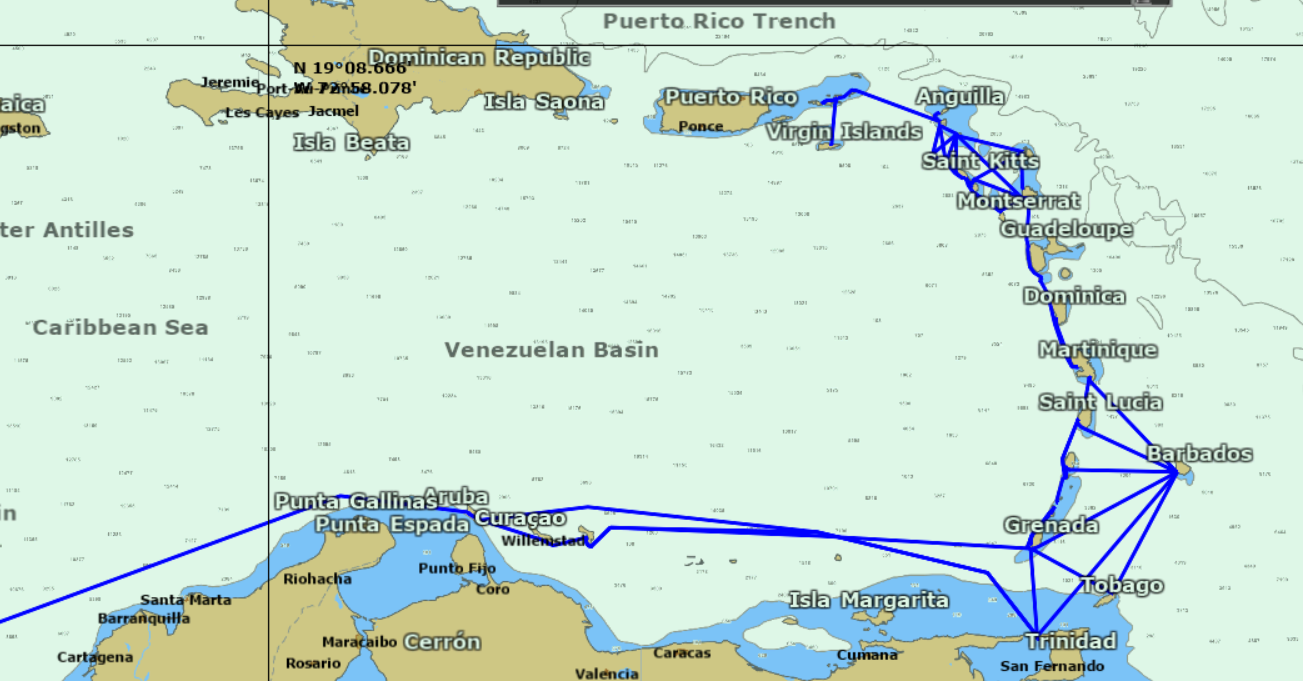
To give you some examples, I re-created the route we took through the Caribbean, starting from the British Virgin Islands and working our way through the Leeward and Windward Islands in the Eastern Caribbean before heading west for Panama and the canal. This covered a period of almost a year, since we often spent weeks or even months in some places, especially during hurricane season.
Our Caribbean Sailing Itinerary:
| Leaving | Port | Arriving | Port | Distance (nm) | Hours at Six Knots |
|---|---|---|---|---|---|
| British Virgin Islands | Virgin Gorda | St. Martin | Marigot | 79 | 13 |
| St. Maarten | Simpson Bay | St. Eustatius | Oranjestad | 35 | 6 |
| St. Eustatius | Oranjestad | St. Kitts | Basseterre | 21 | 4 |
| St. Kitts | Basseterre | Antigua | Falmouth | 62 | 10 |
| Antigua | Falmouth | Guadeloupe | Deshaies | 43 | 7 |
| Guadeloupe | Les Saintes | Dominica | Portsmouth | 22 | 4 |
| Dominica | Portsmouth | Martinique | Fort de France | 68 | 11 |
| Martinique | Le Marin | St. Lucia | Rodney Bay | 24 | 4 |
| St. Lucia | Soufriere | St. Vincent & the Grenadines (SVG) | Bequia | 55 | 9 |
| SVG | Bequia | SVG | Tobago Cays | 26 | 4 |
| SVG | Union Island | Grenada | Carriacou | 8 | 1 |
| Grenada | Carriacou | Grenada | Prickly Bay | 42 | 7 |
| Grenada | Prickly Bay | Trinidad | Chaguaramas | 81 | 14 |
| Trinidad | Chaguaramas | Aruba | Oranjestad | 530 | 88 |
| Aruba | Oranjestad | Panama | Colon | 632 | 105 |
These distances assume coast-hopping from one end of the island to a different departure point, which we almost always did. Also, the Trinidad to Aruba leg is longer than a rhumb-line route; due to political and social instability in Venezuela we plotted a course to keep us well north of Venezuelan waters and did not want to shorten the route by cruising the coast.
You can download the Excel spreadsheet I've used to calculate these itineraries here for free.
Here's the Best Time to Sail the Caribbean (3 Tips)
We could spend several more years and have a different experience, since we we only saw a fraction of what there was to see. There's no right way or wrong way to cruise the Caribbean, but if you plan, you can see a lot no matter how you choose to sail it.
Caribbean Geography
Names of the regions in the Caribbean can be a bit confusing at first glance, as there are several names to describe regions, and some of them overlap, are sub regions of others, or cover the same areas. Cruising and travel guides, web sites, and magazine articles often throw these terms around, and it's can be confusing to know where they are talking about.
The West Indies, a misnomer dating back to the days of Christopher Columbus, refers to pretty much all the Caribbean islands and the Bahamas. The Antilles refers to all the Caribbean islands but does not include Bahamas, which are part of the Lucayan Archipelago.
The Greater Antilles includes the islands of Cuba, the Cayman Islands, Hispaniola (with the Dominican Republic and Haiti), Jamaica, and Puerto Rico. The Lesser Antilles are all the rest of the islands.
Then we get into the Leeward Islands, Windward Islands, and the Leeward Antilles. We'll get to those in a moment.
When talking about moving between islands, cruisers will often use the phrases up island and down island. These refer to islands to the north as "Up" and those to the south as "Down" the island chains.
So when a cruiser in St. Martin may tell you he's heading "down island" next month, he's planning somewhere south, probably St. Barts, St. Kitts, Statia, or Antigua. It's vague, but it's a common way to discuss plans, especially when they aren't settled.
Confused yet? Because there are further breakdowns and groupings you may hear which come from which European powers dominated which islands politically and culturally during the 17th through 19th centuries. When someone refers to the Spanish West Indies, British West Indies, Dutch West Indies and even the Danish West Indies, it means islands where those colonial powers held the most sway.
So why are we getting into this? To give you a sense of why and how you might plan your sailing itineraries. Most island hopping is in the Eastern Caribbean, in the Windward and Leeward Islands. That's where you find most of the small island nations and territories you can sail between in less than a day.
How Long Does It Take to Sail to the Caribbean? (UK, NYC)
Leeward Islands
The island groups are named relative to the trade winds, which blow from the south and southeast. Windward Islands are therefore "to windward" or to the south, and the Leewards are "to leeward" and downwind in the trades.
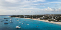
The major island groups and countries in the Leewards, from north to south, are the U.S. Virgin Islands, the British Virgin Islands, Anguilla, St. Martin/Sint Maartin, St. Barthélemy ("St. Barts"), Saba, St. Eustatius ("Statia"), St. Christopher ("St. Kitts") and Nevis, Antigua and Barbuda, Montserrat, Guadeloupe, and Dominica.
St. Martin (the French side of the split island of Saint Martin), St. Barts, and Guadeloupe are French overseas territories. Anguilla and the British Virgin Islands are U.K. territories, the U.S. Virgin Islands are an American territory, and the Netherlands administer Saba, Statia, and the Dutch Half of Sint Maarten. The remaining islands are independent island nations.
Windward Islands
Heading further south, the Windward islands start with Martinique, then St. Lucia and St. Vincent and the Grenadines. Barbados lies about eight-five miles east of St. Vincent, and can be a tricky upwind sail. South of the Grenadines lies Grenada and its possession Carriacou, then Trinidad and Tobago at the southernmost point in the Windwards.
Of those, only Martinique is a French overseas territory, the rest are all independent countries.
Leeward Antilles
The Dutch portion of the Leeward Antilles is sometimes referred to as the "ABC's" from the first letter of the island names - Aruba, Bonaire, and Curaçao.
The Leeward Antilles also includes several islands which belong to Venezuela, but take care visiting them. The unstable situation on the mainland means conditions may be unpredictable. Also, your insurance company may not permit travel to some of them without advanced permission. The Roques Archipelago is one of the more popular spots, but check current conditions before planning a visit.
Travel Times and Distances
There are too many islands to make a "travel time" table like you'd find in a road atlas with every island to every island. Most island passages happen in a more stepwise, logical fashion. Moving at six knots, you don't want to skip something and go back to it, and the islands in the eastern Caribbean are in a somewhat straight line, which makes for an ordered way of going through them. Very few people sail from an island in the Leewards, to say, Aruba or Bonaire.
You will find a table for each major island or island group and distances to common passages from that island. The assumption is you are leaving from and heading to the closest major ports of entry on each island, your time sailing across the island or cruising from one end to the other isn't factored in.
While we can't cover every combination for you, there is more than enough information to give you a sense for how you can island hop, and how long it might take.
Important Notes:
-
All times are based on an average speed made good on the plotted course of 5, 6, or 7 knots. That's total made good towards the route on your GPS. If your cruising speed on the rhumb line is different or you’re tacking back and forth all over the place, adjust times accordingly.
-
We measured courses to just inside the harbor in most cases with a wide safety margin, and not for optimal course length with the absolute shortest route. So when you do your own plots, you will get different numbers if you choose more careful routes, stay closer to shorelines, or plot more exact departure and arrival points.
-
Distances are in Nautical Miles, times are in hours rounded UP to the nearest hour. By the time you haul anchor and set the sails and drop anchor on the other end, even a three-mile trip will take you an hour.
-
Where the "island" column is blank on departure, it's a repeat of the row above. If it’s blank on arrival/to, there's only a single island destination in that country. This column is for archipelagos and destinations with multiple islands.
-
The destinations are from north to south, and reverse routes and distances are not given to keep the tables simpler to read. To get times going the other way, just use the reverse route to your departure point.
Leeward Island Distances
U.S. Virgin Islands
Travel times between the USVI and British Virgin Islands can be quite short, and you must clear in and out every time you move between the USVI and BVI.
| Island | Departure Port | To | Island | Arrival | Dist. | 5 Kts | 6 Kts | 7 Kts |
|---|---|---|---|---|---|---|---|---|
| St. Thomas | Charlotte Amalie | USVI | St. Croix | Frederiksted | 38 | 8 | 7 | 6 |
| Charlotte Amalie | USVI | St. Croix | Christiansted | 38 | 8 | 7 | 6 | |
| Red Hook | USVI | St. John | Cruz Bay | 3 | 1 | 1 | 1 | |
| Red Hook | BVI | Tortola | Soper's Hole | 9 | 2 | 2 | 2 | |
| Red Hook | BVI | Tortola | Road Town | 16 | 4 | 3 | 3 | |
| St. John | Cruz Bay | BVI | Tortola | Road Town | 14 | 3 | 3 | 3 |
| St. Croix | Christiansted | BVI | Tortola | Road Town | 40 | 9 | 7 | 6 |
British Virgin Islands
Many heading down island from the BVIs leave from Virgin Gorda, as it is the furthest island to the east. However, the other islands are close enough together that you can clear out of Tortola and only add a few more hours travel time to St. Martin.
| Island | Departure Port | To | Island | Arrival | Dist. | 5 Kts | 6 Kts | 7 Kts |
|---|---|---|---|---|---|---|---|---|
| Tortola | Road Town | BVI | Virgin Gorda | North Sound | 16 | 4 | 3 | 3 |
| Virgin Gorda | North Sound | St. Martin | St. Martin | Marigot | 79 | 16 | 14 | 12 |
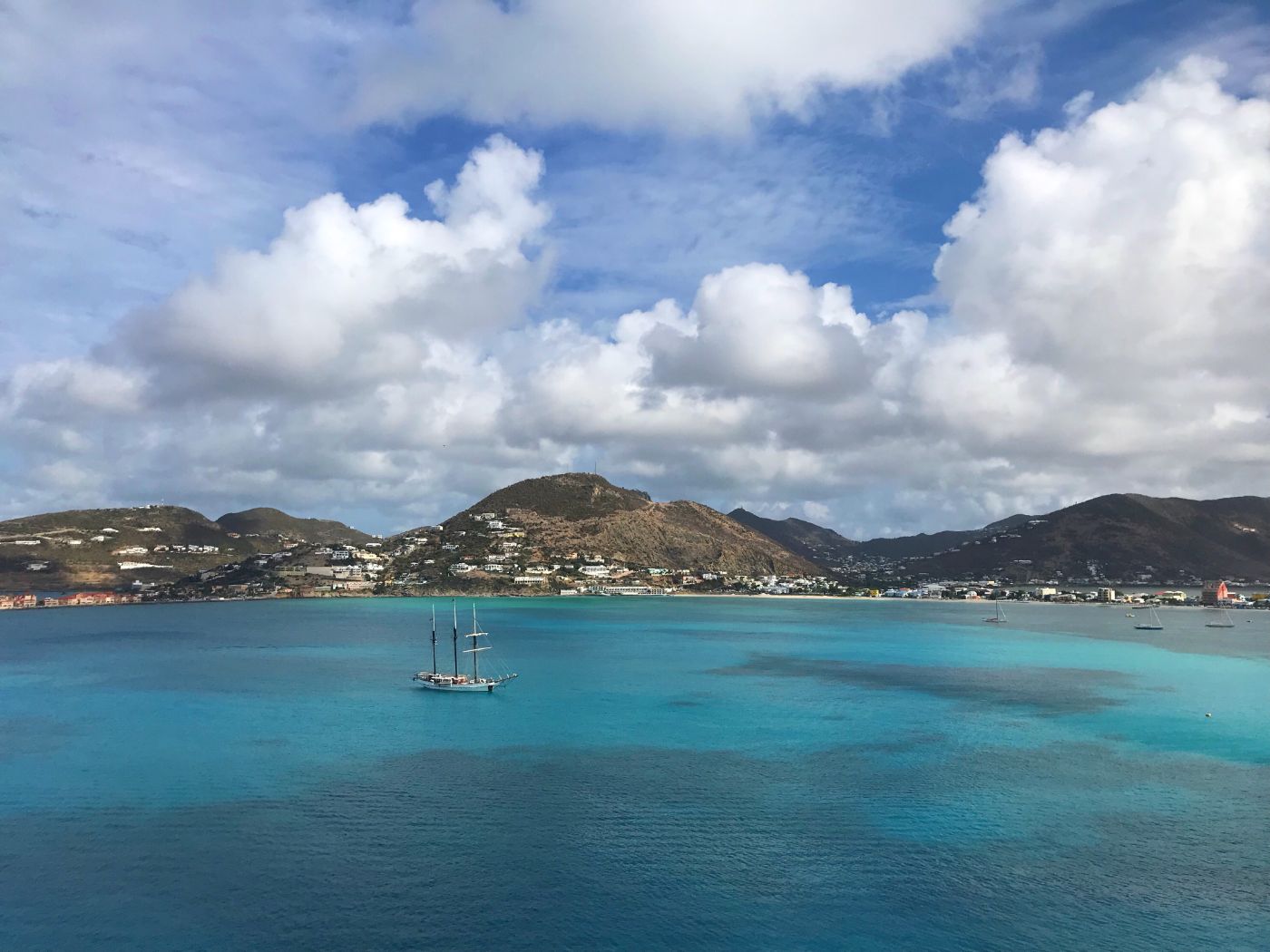
St. Martin
St. Martin is split between the French and Dutch governments, and you need to clear out with the proper authority when leaving. You can stay on the French side in the lagoon, but you still must transit the Dutch side to leave via the Simpson Bay bridge, so you still have to deal with the Dutch authorities to pay the fees.
| Departure Port | To | Island | Arrival | Dist. | 5 Kts | 6 Kts | 7 Kts |
|---|---|---|---|---|---|---|---|
| Marigot | Anguilla | Road Bay | 13 | 3 | 3 | 2 | |
| Simpson Bay | Saba | Fort Bay | 29 | 6 | 5 | 5 | |
| St. Eustatius | Orenjestad | 35 | 8 | 6 | 6 | ||
| St. Barts | Gustavia | 17 | 4 | 3 | 3 |
St. Barts
You'll see some of the most spectacular megayachts in world in St. Barts, it's a popular spot for the larger boats.
| Departure Port | To | Island | Arrival | Dist. | 5 Kts | 6 Kts | 7 Kts |
|---|---|---|---|---|---|---|---|
| Gustavia | Saba | Fort Bay | 30 | 7 | 6 | 5 | |
| St. Eustatius | Orenjestad | 28 | 6 | 5 | 5 | ||
| Antigua & Barbuda | Barbuda | Codrington | 59 | 12 | 10 | 9 | |
| St. Kitts | St. Kitts | Basseterre | 43 | 9 | 8 | 7 | |
| Antigua & Barbuda | Antigua | Falmouth | 85 | 18 | 15 | 13 |
What's the best boat for Caribbean island-hopping? Find out here.
St. Eustatia
Statia's open roadstead anchorage can be uncomfortable in the wrong winds, so watch the weather. Nearby Saba isn't recommended as a strong wind anchorage, either.
| Departure Port | To | Island | Arrival | Dist. | 5 Kts | 6 Kts | 7 Kts |
|---|---|---|---|---|---|---|---|
| Oranjestad | Saba | Fort Bay | 18 | 4 | 4 | 3 | |
| Antigua | Barbuda | Codrington | 59 | 12 | 10 | 9 | |
| St. Kitts | St. Kitts | Basseterre | 21 | 5 | 4 | 4 | |
| Antigua | Antigua | Falmouth | 62 | 13 | 11 | 9 |
St. Kitts & Nevis
If you are leaving from St. Kitts, you can go through the narrows between the islands. But make sure you pay atttention to the shallows at the end of the narrows and pick the north or south channel out.
| Island | Departure Port | To | Island | Arrival | Dist. | 5 Kts | 6 Kts | 7 Kts |
|---|---|---|---|---|---|---|---|---|
| St. Kitts | Basseterre | St. Kitts | Nevis | Charlestown | 10 | 3 | 2 | 2 |
| Basseterre | Antigua | Barbuda | Codrington | 48 | 10 | 9 | 7 | |
| Basseterre | Antigua | Antigua | Falmouth | 62 | 13 | 11 | 9 | |
| Basseterre | Montserrat | Little Bay | 43 | 9 | 8 | 7 | ||
| Nevis | Charlestown | Montserrat | Little Bay | 33 | 7 | 6 | 5 |
Antigua and Barbuda
Although St. John's is a major port, it's not a small boat friendly harbor. Most sailing yachts come to Falmouth/English Harbour, though you can also clear in to Jolly Harbour, but there is not much of an anchorage.
| Island | Departure Port | To | Island | Arrival | Dist. | 5 Kts | 6 Kts | 7 Kts |
|---|---|---|---|---|---|---|---|---|
| Antigua | St. John's | Antigua | Barbuda | Codrington | 33 | 7 | 6 | 5 |
| Antigua | Falmouth | Monserrat | Little Bay | 29 | 6 | 5 | 5 | |
| Antigua | Falmouth | Guadeloupe | Guadeloupe | Deshaies | 43 | 9 | 8 | 7 |
Guadeloupe
Guadeloupe has several smaller islands on the south end which you can visit. The major town of Pointe-à-Pitre is an important shipping harbor and less popular with sailing visitors.
| Island | Departure Port | To | Island | Arrival | Dist. | 5 Kts | 6 Kts | 7 Kts |
|---|---|---|---|---|---|---|---|---|
| Guadeloupe | Deshaies | Guadeloupe | Les Saintes | Terre-de-Haut | 33 | 7 | 6 | 5 |
| Les Saintes | Terre-de-Haut | Dominica | Portsmouth | 23 | 5 | 4 | 4 |
Dominica
In Dominica's two major cruising ports, organized and helpful "boat boys” will greet you. It's an established part of the local economy, and they will handle much of what you need on the island like tours and supplies.
| Departure Port | To | Island | Arrival | Dist. | 5 Kts | 6 Kts | 7 Kts |
|---|---|---|---|---|---|---|---|
| Roseau | Martinique | Fort de France | 51 | 11 | 9 | 8 |
Windward Islands Distances
Martinique
Le Marin is the most popular port for cruising and charter yachts. It has plenty of anchorage space, it’s protected, and most marine services.
| Departure Port | To | Island | Arrival | Dist. | 5 Kts | 6 Kts | 7 Kts |
|---|---|---|---|---|---|---|---|
| Le Marin | St. Lucia | Rodney Bay | 24 | 5 | 5 | 4 | |
| Le Marin | Barbados | Bridgetown | 113 | 23 | 19 | 17 |
If you want to charter a Caribbean yacht, the all-in cost can range from $30,000 to over $1,000,000 per week.
St. Lucia
Rodney Bay in the north has most of the marine services, though the scenic Pitons near Soufrière in the south is a popular departure point. You will be approached by "boat boys" in Soufrière, though they are not as organized as those in Dominica they can still be helpful.
| Departure Port | To | Island | Arrival | Dist. | 5 Kts | 6 Kts | 7 Kts |
|---|---|---|---|---|---|---|---|
| Soufrière | Barbados | Bridgetown | 100 | 21 | 17 | 15 | |
| Soufrière | SVG | St. Vincent | Kingstown | 48 | 10 | 9 | 7 |
| Soufrière | SVG | Bequia | Port Elizabeth | 55 | 12 | 10 | 8 |
Barbados
Barbados is one of the more off the beaten path islands. It sees less traffic because it's a long trip there and back, with a lot of upwind.
| Island | Departure Port | To | Island | Arrival | Dist. | 5 Kts | 6 Kts | 7 Kts |
|---|---|---|---|---|---|---|---|---|
| Barbados | Bridgetown | SVG | St. Vincent | Kingstown | 96 | 20 | 17 | 14 |
| Grenada | Grenada | Prickly Bay | 144 | 29 | 25 | 21 | ||
| Trinidad & Tobago | Tobago | Charlotteville | 120 | 25 | 21 | 18 | ||
| Trinidad & Tobago | Trinidad | Chaguaramas | 190 | 39 | 32 | 28 |
St. Vincent & the Grenadines (SVG)
This sprawling country has many smaller islands you can hop between, most are only a few miles apart. Many clear into Bequia instead of St. Vincent on the way south.
| Island | Departure Port | To | Island | Arrival | Dist. | 5 Kts | 6 Kts | 7 Kts |
|---|---|---|---|---|---|---|---|---|
| St. Vincent | Kingstown | SVG | Bequia | Port Elizabeth | 10 | 3 | 2 | 2 |
| Bequia | Port Elizabeth | SVG | Tobago Cays | Tobago Cays | 26 | 6 | 5 | 4 |
| Union Island | Grenada | Grenada | Carriacou | Hillsborough | 8 | 2 | 2 | 2 |
| Union Island | Grenada | Grenada | Grenada | St. George's | 41 | 9 | 7 | 6 |
Grenada
Grenada is a popular hurricane season destination for full time cruisers, because it's far enough south to reduce (but not eliminate) storm risk, and it's close enough to Trinidad to sail there on an overnight if a storm threatens. Look for most of the cruising community in the southern bays and harbors.
| Island | Departure Port | To | Island | Arrival | Dist. | 5 Kts | 6 Kts | 7 Kts |
|---|---|---|---|---|---|---|---|---|
| Carriacou | Hillsborough | Grenada | Grenada | St. George's | 35 | 8 | 6 | 6 |
| Carriacou | Hillsborough | Grenada | Grenada | Prickly Bay | 42 | 9 | 8 | 7 |
| Grenada | Prickly Bay | Trinidad & Tobago | Trinidad | Chaguaramas | 81 | 17 | 14 | 12 |
| Grenada | Prickly Bay | Trinidad & Tobago | Tobago | Charlotteville | 83 | 17 | 14 | 12 |
| Grenada | Prickly Bay | Bonaire | Bonaire | Kralendijk | 400 | 81 | 67 | 58 |
Trinidad & Tobago
Trinidad is one of the largest islands in the Caribbean and is in the lower corner. There aren't any Caribbean destinations beyond Trinidad.
| Island | Departure Port | To | Island | Arrival | Dist. | 5 Kts | 6 Kts | 7 Kts |
|---|---|---|---|---|---|---|---|---|
| Trinidad | Chaguaramas | Bonaire | Bonaire | Kralendijk | 437 | 88 | 73 | 63 |
Leeward Antilles
The Leeward Antilles aren't in "Island Hopping" range, since reaching them from the Windward Islands is a multi-day offshore passage. Routes between the ABCs are included for completeness, as it is possible to charter there and a stop on the way across to Panama is common. The islands are not known for great facilities for visiting yachts, though the sailing there is lovely.
| Island | Departure Port | To | Island | Arrival | Dist. | 5 Kts | 6 Kts | 7 Kts |
|---|---|---|---|---|---|---|---|---|
| Bonaire | Kralendijk | Curaçao | Curaçao | Willemsted | 41 | 9 | 7 | 6 |
| Curaçao | Willemsted | Aruba | Aruba | Orenjestad | 70 | 15 | 12 | 11 |
You can download the Excel spreadsheet I've used to calculate these itineraries here for free.
Did you find the answer to your specific question?
👍 16 👎 10
Comments
Gunter from "mon rêve"
Thank you, William, for sharing this helpful item.
Christian Dolman
Hi, many thanks for the information was most helpful. My partner and I are looking to take 6months off work and Sail around the Caribbean. We are relatively new to sailing.
We are aim to start in November 2024, should have a budget for a yacht of approximately £40000, could you give us some advice on what type of yacht would best suit the trip we have planned and what kit/equipment we should look to take. Any advice would be greatly appreciated.
Kind regards
Christian
Vance Taylor
What is the best time to sail from Bonaire to Barbados ? How about August/September?
Leave a comment