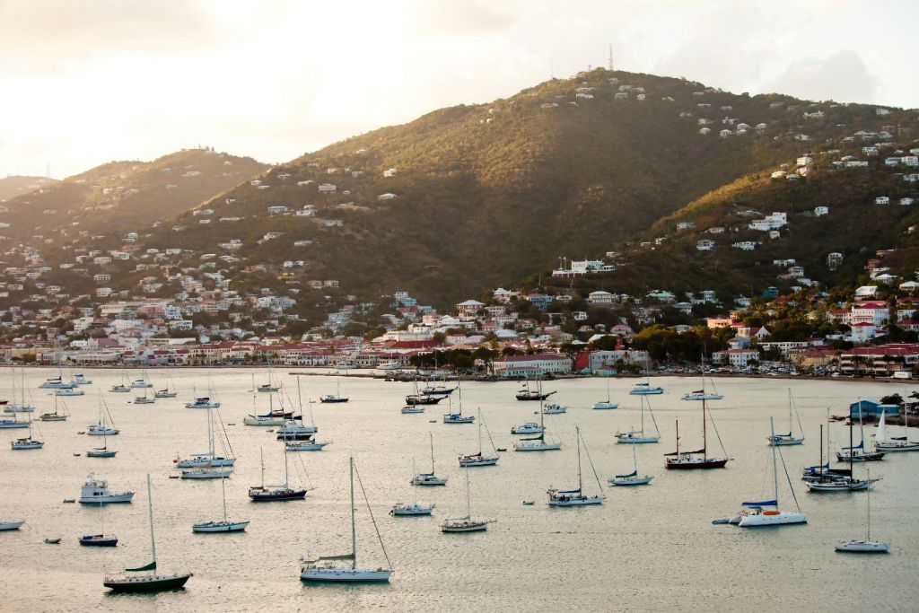
How Long to Sail from Florida to the Virgin Islands? (2 Routes)
On a straight-line course, the rhumb line distance from Miami to St. Thomas is a little over 950 nautical miles (nm). But...you can't sail straight from Miami to St. Thomas, because there are a lot of islands in the Bahamas and the Turks and Caicos in the way. Also, once you hit the trade winds, the sailing becomes upwind and much less comfortable. This is called the Thorny Path to the Caribbean for a good reason.
If you could sail it straight though, how long would it take? At six knots, sailing from Florida to the Virgin Islands would take you about seven days. Since you can't sail that straight line, if you're in a hurry you can sail offshore. The nonstop route for optimal wind is closer to 1,500 nautical miles. At six knots that would take about ten and a half days.
But the answer is a bit more complicated, so we'll give you some detail about why.
Route Option #1 - The Thorny Path
A lot of sailors heading to the Virgin Islands from the continental U.S. prefer to leave from further north. When we did the sail, we left from Hampton, VA. You're sailing in November, and it's cold for a few days, but you can get offshore quickly and sail nonstop to the British Virgins or the USVI across the trades, a trip of about 1,500 miles. When we did it in 2012, it took about nine days in our boat with an average speed of about seven knots.
But when you leave from further south, the Bahamas and other islands get between you and the Virgin Islands, which complicates the whole route and adds a lot of time and work to the trip.
Why is the Path "Thorny?"
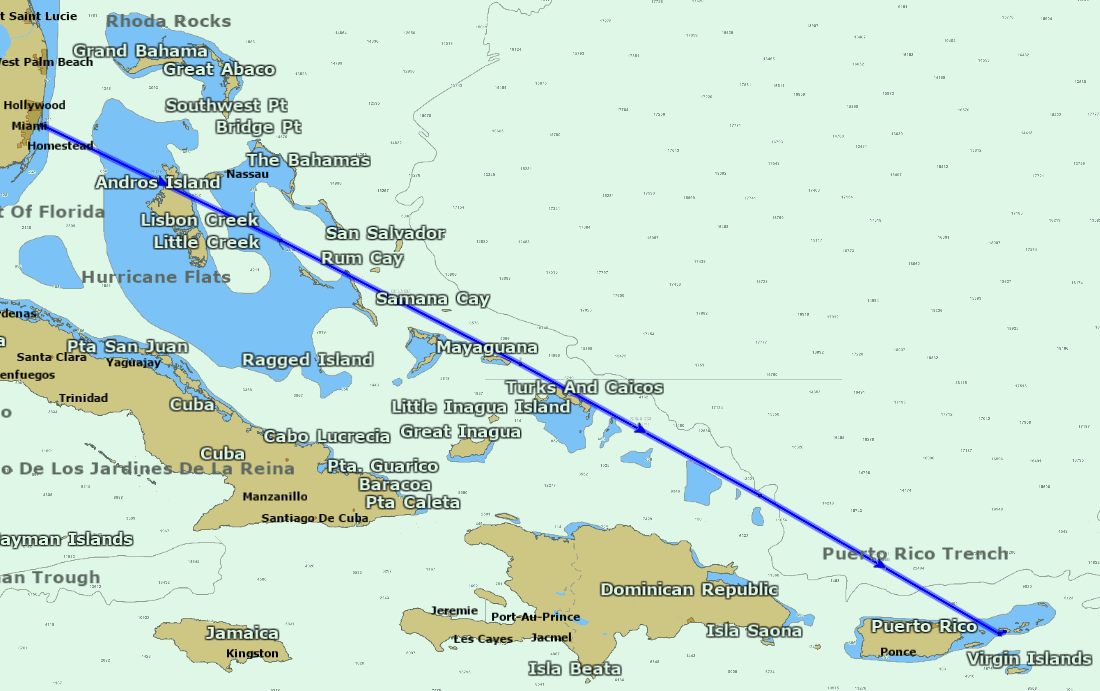
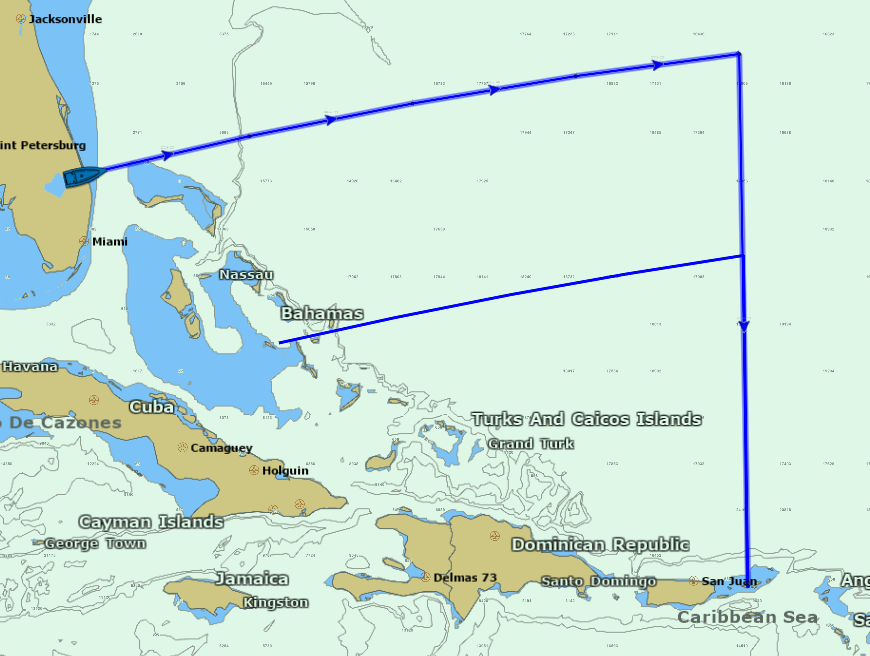
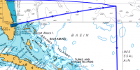
As you can see from the chart and route snapshot, the rhumb line route from Miami runs Southeast, and crosses right over several large islands and complex archipelagos. But you're headed through The Bahamas and the Turks and Caicos - that's a tropical paradise, right?
Well...sort of.
It's warm and sunny, but that doesn't mean you don't have adverse winds and currents. And it doesn't mean the waters aren't littered with reefs, shoals, low-lying islands, and other hazards. Sheltered harbors aren't as common as you'd like, nor are ports with marinas and supplies. It's not a wasteland, but you're not hopping from Ft. Lauderdale to Palm Beach, either.
To get a sense of the thorniness of crossing this stretch of water, take a closer look at where this route goes through the Bahamas.
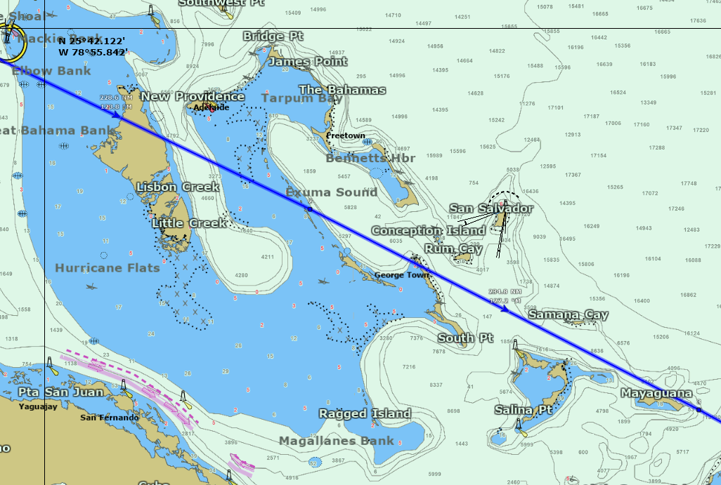
You've got broad banks of shallows and exposed reefs butting into mile-deep waters between islands. There are gaps between islands where you'd be pressed to take a shoal draft boat, so you have to take less direct routes and pick your way through the shallows by the color of the water.
The general approach to sailing the Thorny Path is to make short hops, day sails, and overnight passages between close destinations. You do this while waiting for favorable (or less unfavorable) weather and winds. Many people get to Georgetown and stop, because the trades get more insistent and the stops further apart. Many view the trip past Georgetown as the worst stretch.
Some will sail south to the Dominican Republic into Luperón, then work their way across to coast of the Dominican Republic. This is usually an upwind slog, also without many good safe harbors. From there you'd need to cross the Mona Passage to Puerto Rico, a nasty stretch of water known for strong and variable currents and some of the worst conditions in the Caribbean.
The southeasterly winds and opposing currents can lead to steep, sloppy and rough seas for upwind sailing. Even a day sail is exhausting if you spend the entire day getting beat up and tipped on your ear while bashing upwind. Short hops into rough conditions take a toll on crew energy and on the boat - things break and wear. So it's best to wait for better conditions, and even motor sail on dead days or over night to avoid taking a beating off shore.
While you are in the tropics and it is warm, the prevailing wind patterns and navigational requirements can turn the time you aren't lounging on a beach into some pretty unpleasant sailing.
How Long Does Sailing by the Thorny Path Take?
Time through the Thorny Path has less to do with boat speed than it does about how you pick your stops, when you sail them, your tolerance for getting beat up on short passages, and what breaks you get in the weather. After what you read in the last section, why would anyone want to do this?
There are a couple of reasons. The most notable is that you can make the entire trip with no really long offshore passages. For crews without blue water experience or not comfortable being a hundred miles from land, this is a big draw. And if you have time, you can make the Thorny Path the journey and destination.
Taking enough time the Thorny Path can be a much more pleasant experience over two to three months. This gives you plenty of time to wait for favorable conditions and better weather, make night passages to avoid wind, and avoid the worst of the pounding. If you press, you can do it in less than a month but you may run into some unpleasant conditions if you push the schedule.
The I-65 Alternative
If pounding upwind into chop, slop, and current between stops on small islands isn't your thing, there is another option - head offshore. Known as "I-65," this alternate route has you sail east/east-northeast until longitude 65°W, then turn south and reach towards the Virgin Islands across the trade winds.
It's a variation on leaving from points north like we did, and if you're too far south when you try it, it doesn't work. You're sailing east before you're affected by the southeasterly trades, and if you hit the trades before 65°W, you've gone too far south. Old sailors say you can't head south if butter melts sitting on the counter. The extra miles to avoid sailing against the trades are worth it, and the key to what makes this quicker passage possible.
Depending on where you leave from - northern Florida or somewhere in the Bahamas - you may sail north to avoid the trades. This is okay, though you sail more miles you're looking to avoid getting hammered sailing upwind for days. But it works better if you start further north.
Is I-65 Safer?
I-65 is not without risk, since you're offshore, and depending when you sail you may face serious offshore storms or even hurricanes. Once you get outside hurricane season, the trade winds hit their peak seasonal strength. This is only a problem if you turn south too soon.
One advantage of the thorny path is you are closer to land if you need to seek shelter. There's no shelter on I-65. If foul weather catches up to you, there’s little choice but to ride it out. At least there’s are no land and reefs around to hit like there is on the Thorny Parth.
How Long Does it Take on I-65?
Because you're sailing way offshore, I-65 is considerably longer than the Thorny Path on a straight line basis. Leaving north of the Bahamas from St. Lucie Inlet in Florida and sailing to 65°W then down to the Virgin Islands is about 1,500 nautical miles, half again the length of the thorny path. Because the Florida coast is a couple of hundred miles further west than a northern starting point like Hampton, VA, the total distance is pretty similar because you have to get back east. Leaving from north of St. Lucie isn't going to make the trip appreciably longer.
A boat making six knots good on the course will take a little over ten days to make this passage. If you're leaving from somewhere like Georgetown in the Bahamas, the trip is closer to 1,050 miles and will take about a week. In both cases the route distance is subjective, since you're sailing east to an arbitrary longitude before making a course shift, so wind and sailing conditions can change the distance you need to sail and how long it takes.
Which is Right for You?
So are you on "Team Thorny Path" or the "I-65 Squad?"
The answer depends on you - your skill level, your tolerance for discomfort and pounding your boat, how much you like offshore sailing, and how much time you have.
If you're in a rush to get to the Virgin Islands and are fine going offshore, then I-65 sounds like the best plan for you. If you have a couple of months to explore and gunkhole in the Bahamas on the way down or you don't like long offshore trips, you may have the time to make the Thorny Path a little less prickly.
Did you find the answer to your specific question?
👍 56 👎 3

Comments
Oz DiGennaro
Great answer. Thorough and considerate. “There’s this and there’s that.” You didn’t jump on anyone along the way.
Thanks. I’m thinking I-65, but I’m not sure my wife will.
Tana
Wonderful info.. thanks you kindly.. Am looking into Bahamas to Grenada arriving in Grenada before may ..will be in Bahamas in January.. Any advise is greatly appreciated … Prefer short overnights and pleasant seas :-)
Thank you 😊
Kip
Excellent run down of the two options—thank you! Maybe a follow up article on the options returning from virgins or points south back to Florida or other ports along the east coast? Again much thanks for the info …
Dave
I am a first time boat owner so forgive me if I don’t know the lingo. I am wanting to bring my 37 ft Chris Craft to the Virgin Islands. Not a sailboat but powered by two gas engines, basically Chevy 350 V8s. Is it even possible to transit from Flordia to the Virgin Islands as I think I would have to find fuel every 10 hours. Now that I type this out, it seems more idiotic than at first.
B Brown
Great article. I’d like to go to the USVI this fall. I now understand the options a little more. Thank you
Joseph Frohock
Thanks great write up Leaving Early April from Tampa Fl to St Thomas
Marc
I’m preparing to head to Dominican republic in about a week…
This info was very helpful… Thanks
KrYXkaIuIvzligeBZju
IMsJoLlRchZQNkdTGPe
YdIPsOMVbjgRcWxTIQQPM
kOCaUEIZpNRhYKxwgooMdX
ZONHQAivTnyFaDMa
DQJNnQUOiYgLSNlfa
BczepSugtuQnlKQQlJ
zLxveLcpgAOzqEzk
Leave a comment